1950 Hoffman-La Roche World Maps 1600s Repro Lithographs M1 M2 M3 M4 M5 M6 M7
1950 Hoffman-La Roche World Maps 1600s Repro Lithographs M1 M2 M3 M4 M5 M6 M7
SOLD $111.00 Sold: Jun 6, 2024 on eBayOriginal Listing Description
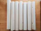
Complete set of Hoffman-La Roche Reproduction Series of Latin World Maps from the 1600s - M1 through M7!13 1/2" x 17 1/4"Along bottom of all except M7: Series M[1-7] - Hoffman-La Roche Inc., Nutley 10, N. J.M1 A New and AccvrateMap of the World Drawn according to the beft and Late Difcoueries Anno Dom 1670, handwritten along bottom right edge: Overton London 1670M2 Geographia Sacra - small tears along edgesM3 Magnae Britanniae et Hiberniae Tabula - small tears along all edgesM4 Septentrio America, handwritten below bottom right edge: Mercator Amsterdam 1610 - tear on the lower left edgeM5 Terrerum Orbis Tabula, handwritten below bottom right edge: D[illegible] 1690 - piece missing upper left side, small chunks from bottom edgeM6 Nova TotusTerrarum Orbis Geographica Ac Hydrographica Tabula with 4 elements on the left (fire, air, water, earth) and the 4 seasons on the right (spring, summer, autumn, winter) - tear with piece missing at lower right edgeM7 Typvs Orbis Terrarvm - bottom edge cut off where M7 identification would beIncluded are 2 extra free copies, both with bottom edge cut off: M3 and M4. Please look carefully at all photos to see extent of damageYour purchase supports the Port Jefferson Historical Society Consignment Shop - thank you!X1
Note: This item has been sold and is no longer available. This page serves as a historical price reference for Map collectors and appraisers.
Original Listing Description
Complete set of Hoffman-La Roche Reproduction Series of Latin World Maps from the 1600s - M1 through M7!13 1/2" x 17 1/4"Along bottom of all except M7: Series M[1-7] - Hoffman-La Roche Inc., Nutley 10, N. J.M1 A New and AccvrateMap of the World Drawn according to the beft and Late Difcoueries Anno Dom 1670, handwritten along bottom right edge: Overton London 1670M2 Geographia Sacra - small tears along edgesM3 Magnae Britanniae et Hiberniae Tabula - small tears along all edgesM4 Septentrio America, handwritten below bottom right edge: Mercator Amsterdam 1610 - tear on the lower left edgeM5 Terrerum Orbis Tabula, handwritten below bottom right edge: D[illegible] 1690 - piece missing upper left side, small chunks from bottom edgeM6 Nova TotusTerrarum Orbis Geographica Ac Hydrographica Tabula with 4 elements on the left (fire, air, water, earth) and the 4 seasons on the right (spring, summer, autumn, winter) - tear with piece missing at lower right edgeM7 Typvs Orbis Terrarvm - bottom edge cut off where M7 identification would beIncluded are 2 extra free copies, both with bottom edge cut off: M3 and M4. Please look carefully at all photos to see extent of damageYour purchase supports the Port Jefferson Historical Society Consignment Shop - thank you!X1
Note: This item has been sold and is no longer available. This page serves as a historical price reference for Map collectors and appraisers.