Map Collectibles : Willem Map Value Guide
Free Map Collectibles : willem Map price guide. Find out how much your map collectibles : willem map are worth with current market values.
average value
$215.70
low
$18.38high
$3,000.00Example: "vintage basket", "rare ornament", "collectible plate"
Sold on eBay February 2nd, 2024
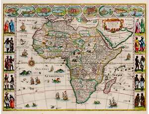
17h Century Antique Map of Africa by Blaeu, 1635
eBay Africae Nova DescriptioBy: Willem Janszoon BlaeuDate: 1635 (circa) 16 x 22 inches (40.5 x 56 cm)This is a superb example of the second state of Blaue’s important map of Africa, one of the iconic maps of the era by the leading map publisher of the Dutch Golden Age of cartography. By the time Blaeu made this map Europeans had navigated and subsequently charted Africa’s perimeter to the extent that in form it is close to a modern satellite image of it. The map was an immediate success, and several states of it were eventually published.The interior of the continent is divided into countries, kingdoms and colonies. The coasts are detailed with cities, ports and estuaries and the interior richly embellished with examples of African fauna. Myriad mountain ranges crisscross the continent, and large lakes and river systems are depicted.The top border features nine vignettes including cities such as Tangiers, Alexandria and Cairo to name a few, along with the island of Mozambique, the mine at St. George in Guinea, and the Canary Islands. The cities depict the wealth enjoyed by ports of the African continent in the 17th century. Each side border is formed by vignettes of indigenous peoples, men and women, in native costume. The decorative cartouche features a lion along with some luscious appearing fruit and other flora. Sea monsters frolic in the seas, which are dotted with seagoing vessels at full sail and even some flying fish.Condition: This map is in A condition with ample margins on all sides a lovely hand coloring. Inventory #120761932 S. Halsted St. #200 Chicago, IL 60608 | P: (312) 496 - 3622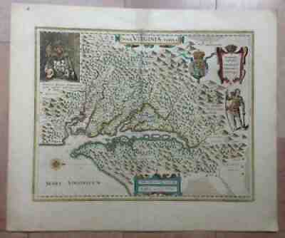
Sold on eBay Jul 14, 2021
VIRGINIA AMERICA 1635 WILLEM BLAEU UNUSUAL LARGE ANTIQUE MAP 17e CENTURY
Then, the sons of Willem, Johan and Joan, joined him in the firm. They produced their first atlas together in 1630 the "Atlas Appendix". Five years later, their produced their "Atlas Novus", edited in 4 languages.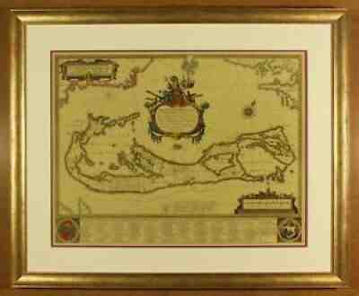
Sold on eBay Apr 13, 2021
Antique map of Bermuda, by Willem Blaeu.
Bermuda, by Willem Blaeu. Date of this map: 1640. Image Size 531 mm by 407 mm.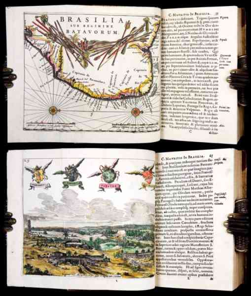
Sold on eBay October 24th, 2024
1660 Barlaeus BRAZIL DUTCH WEST INDIA COMPANY South America TRIBES PLANTS Maps
[Exploration & Travel - South America - Brazil and Chile - 17th century] [Early Americana] [Dutch West India Company] [Maps & Cartography] Printed in Kleve by Tobias Silberling, 1660. Illustrated with 3 folding engraved maps (South America and the Western part of Africa, Brazil under Dutch rule, and Mauritiopolis, Recife and surroundings), 5 folding engraved views, and a (very rare) small plate of solar eclipse (2 of the plates and 2 of the maps with attractive contemporary coloring!). This is the Second Latin edition of this famous history of Dutch rule in Brazil under from 1637 to 1644, which is an important account of Dutch colonial empire in Brazil, considered of "inestimable documentary value" (Borba de Moraes). The first edition, printed in folio (printed by Blaeu in Amsterdam in 1647), is extremely rare and valuable (particularly due to a fire that consumed much of Blaeu's stock). This 2nd Edition was amended by including some additional contributions on the natural history of Brazil by Johan Maurits' physician Willem Piso, dealing with the climate, water, medical plants, sugar cane, wild honey and manioc root of Brazil. “The book was the most comprehensive depiction of Brazil thus far and represents an important work of 17th-century Dutch geography. […] The work provided information about the life and customs of the natives of Brazil. The Tupi living in villages close to the Dutch settlements were loyal allies and open to attempts to evangelize them, whereas it was said that the Tarairiu living in the hinterland of the Rio Grande preferred a nomadic life beyond the boundaries of colonial territories. […] The reports on both tribes came from a company employee called Johan Rabe, who was married to one of the tribal women and acted as a contact man to the Tarairiu for the governor. He probably came with a group of Indians just before the departure of the governor to Recife and accompanied them to the Netherlands, where they performed ritual dances in the Mauritshuis in front of an audience.” (Susanne Friedrich, et al. Transformations of Knowledge in Dutch Expansion) The fine copper-engraved plates are after Frans Post (1612–1680), a painter of the Dutch Golden Age, and the first European artist to paint the New World. In 1636 he traveled to Dutch Brazil in northeast of South America at the invitation of the governor Johan Maurits, and his images, disseminated through these engravings (executed by Jan van Brosterhuisen and Salomon Savery) defined Europe’s vision of the exotic lands of South America. Caspar van Baerle (aka Barlaeus, 1584-1648) was a poet, writer, and one of the great 17th century Dutch humanists. He was commissioned by Prince Johan Maurits van Nassau (1604-1679), known in English as John Maurice of Nassau, to record his tenure as governor general of the Dutch East India Company's possessions in Brazil. Johan Maurits distinguished himself as a military commander on behalf of the Dutch West Indies company (WIC) in Brazil. During his tenure as governor general in 1636–1644 (the eight-year span or octennium of the title) he fought almost constantly against the Spanish Portuguese forces to defend and even to expand Dutch holdings in South America and, eventually, in Africa (in order to re-open the transport of slaves to the Americas). The Dutch eventually sold Brazil to the Portuguese in 1661, and so Maurits’s governorship represents the high-water mark of their power in the Americas. "Barlaeus interwove passages about Johan Maurits’s actions as governor with descriptions of the geography, the flora and fauna, the population and the sugar plantations in the colony. His history painted a picture of a colonial administration that endeavored to be fair to everyone. Johan Maurits and his fellow governors appeased the Portuguese and the other population groups by means of a carefully weighed balance of military presence and measures aimed at promoting prosperity and cooperation. [...] They protected the Indians in the colony from slavery in another guise, placed them under the authority of their own village elders and recruited them as auxiliary forces by rewarding them appropriately. They made allies of savage, cannibal Indians from the outlying areas and tried to civilize them. By promoting economic recovery, Johan Maurits and his fellow administrators did the whole population, including the black slaves, a service. They stopped the extortion of plantation owners by local commanders and restored peace and order to rural areas. They protected the inhabitants against the Portuguese incursions from Bahia and against raids by marauding Maroons in southern Pernambuco. […] They promoted regulated free trade between the colony and the Netherlands, [which] created the opportunity to establish fair prices for Brazilian exports and European imports and encouraged trade with the home country. [...] Barlaeus was consequently able to conclude his history with praise for the governor." (E. Van den Boogaart, A Well-Governed Colony: Frans Posts Illustrations in Caspar Barlaeuss History of Dutch Brazil, The Rijksmuseum Bulletin 59, no. 3 (2011), p.238-239). Bibliographic references: Sabin 3409; Borba de Moraes, 78-79; Bosch 127. Physical description: Octavo, leaves measure 153 mm x 92 mm. Bound in 20th-century half-calf over speckled boards (spine with raised bands, and title-label lettered in Swedish). Pagination: [10], 664, [24] pages + 9 plates. Bound without the engraved half-title, engraved portrait of the dedicatee and his engraved coat of arms, but otherwise complete, with all the illustrative engraved plates and maps: 3 engraved fold-out maps (of which 2 are hand-colored), 5 engraved fold-out plates of views of Brazil (of which 2 are hand-colored), and the rare smaller engraved plate of a solar eclipse (which is missing in most copies). Text printed in single volume, in roman type, with marginal notes in italic letter. Includes a dictionary of the aboriginal language (‘Vocabula chilensia’) on pp. 474-491. Preliminary pages contain Barlaeus’ dedicatory epistle to John Maurice of Nassau. The additional works by Willem Piso occupy pp. 574-664. Included at the end of the volume is an extensive Index rerum. Condition: Very Good. Binding slightly rubbed, with a small chip to front cover and minor edge-wear. Title-page with an early ownership signature and some other ink markings; text-block with occasional light marginal soiling. Plates with occasional light soiling or minor spotting (mostly marginal); one plate with a short closed tear neatly repaired on blank verso (without loss). A few pages with old underscoring and/or small manuscript marginal notes. In all, a clean, solid example, with all text and all the essential plates and maps present, some with very attractive early hand-coloring. Please right-click on thumbnails below and choose "open image in a new window" option to see larger images.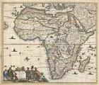
Sold on eBay September 21st, 2024
1685 Frederick de Wit Map of Africa
1685 Frederick de Wit Map of AfricaWE SELL ONLY ORIGINAL ANTIQUE MAPS - NOT Totius Africae Accuratissima Tabula Description: A beautiful example of Frederick De Wit's 1685 map of Africa. The map covers all of Africa as well as parts of Arabia, and the adjacent portions of the Atlantic, Indian, and Mediterranean. the map is a composite of earlier maps, including Jodocus Hondius's map of 1623, Willem Blaeu's map of 1617, and Visscher's map of 1658. The decorative cartouche, appearing in the lower left, features three Moors and a child on the left, and several African with two children on the right. This map follows the typical conventions of the period, but does exhibit several advances, mostly derived from judicious borrowing from other maps. The Nile follows the Ptolemaic model drawing its waters from to great lakes in the southern part of the continent, Zembre (Lake Zaire) andZaflan. On the west coast of the continent several Dutch trading stations, including Fort Nassau and Acara, are noted. It is curious that Dutch information from South Africa, nonetheless, are not present. In the Atlantic, here identified as the Oceanus Aethiopicus, the fictional island of Nuestra I. de Santa Helena, a common feature of contemporaneous French maps by Sanson and others, is identified.This map was published by De Wit in Amsterdam. The map was first issued in 1670 and there are at least six states of the map, the present example being state 4, identifiable by the inclusion of additional information in the interior €šÃ„ì such as the inclusion of Biafra, and the lack of a privilege, a kind of early copyright, which was added in the 5th edition.Size: Printed area measures 19.25 inches high by 23 inches wide.Condition: Very good. Verso repairs of centerfold separations. Closed tears professionally repaired on verso. Blank on verso.Shipping: Shipping rates are not negotiable. Items are shipped within three business days of receiving payment. We are happy to consolidate shipping where possible. The following shipping options are available: 1. FedEx Overnight (45 USD). USA Only. Signature Required. 2. FedEx Ground or Home Delivery (15 USD). USA Only. 1 - 10 days. If your address is a P.O. Box and cannot ship FedEx we will ship USPS Priority and, while we ship promptly, recent postal personnel cutbacks mean that delivery may take time. Signature Required. 3. FedEx International or DHL International EXPRESS (45 USD).4. We can use your FedEx Account Customs: International buyers are responsible for paying duty and taxes on delivery. DHL or FedEx will contact the buyer by telephone to arrange tax payment if it is levied. Duty varies by country and we cannot predict the amount you will be charged. Some countries are duty free, others are not. Typically, a customs duty and/or VAT tax will be assessed on all parcels to continental Europe. Sometimes duty or tax is due in China, but is seems very random. Hong Kong, Singapore, Korea, and Taiwan have never assessed duty on a map we shipped. Maps shipped to the UK should be duty free as educational materials, but from time to time duty of 5% is assessed incorrectly by the UK customs agents. Insurance: All shipments are insured privately against loss and damage. All of our shipments require a signature for insurance purposes. If you have any questions please feel free to email us through eBay.Other Framing: Geographicus recommends basic conservation framing services for any antique paper. We do not offer this service. Antique Map Restoration: Geographicus can repair and restore your antique map. Services include deacidification cleaning flattening and backing. BEWARE anyone attempting to contact you, from a different eBay account, claiming to represent Geographicus Antique Maps. My eBay handle is GeographicusMaps If you are contacted by email by someone offering you my items, please call me directly to be certain you are not dealing with a con artist. "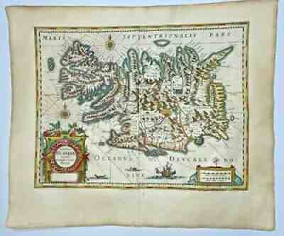
Sold on eBay Feb 21, 2022
ICELAND 1643 WILLEM BLAEU UNUSUAL LARGE NICE ANTIQUE MAP 17e CENTURY
Then, the sons of Willem, Johan and Joan, joined him in the firm. They produced their first atlas together in 1630 the "Atlas Appendix". Five years later, their produced their "Atlas Novus", edited in 4 languages.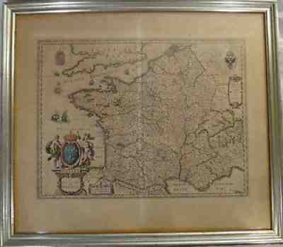
Sold on eBay Jun 12, 2021
Original Old World map - Kingdom of France, Mid- 17th c. W. & J. Blaeu, 23 x 19?
Very fine historical map of France from 1649 is attributed to Willem and Johannes Blaeu. A very nice map with original color. Normal center fold from atlas book.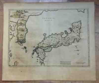
Sold on eBay Apr 29, 2022
JAPAN COREA 1655 WILLEM BLAEU UNUSUAL LARGE ANTIQUE ENGRAVED MAP 17e CENTURY
Then, the sons of Willem, Johan and Joan, joined him in the firm. They produced their first atlas together in 1630 the "Atlas Appendix". Five years later, their produced their "Atlas Novus", edited in 4 languages.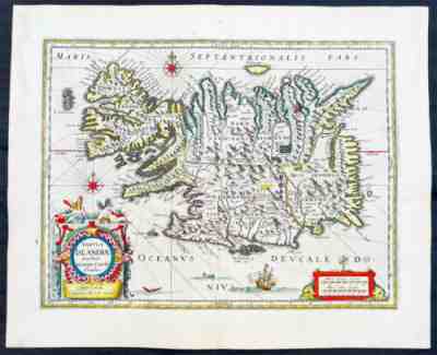
Sold on eBay Aug 10, 2022
1647 Joan Blaeu Antique Map of Iceland - Beautiful Original Hand Colouring
This map, by Willem Blaeu, was engraved by Jodocus Hondius after Joris Carolus, and was published by Willem Blaeus son, Joan, in the 1647 German edition ofAtlas Nouvs. In 1672 a disastrous fire destroyed Blaeu\'s printing house in the Gravenstraat and a year afterwards Joan Blaeu died.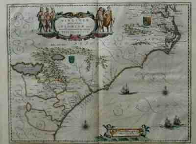
Sold on eBay Nov 26, 2021
Map Willem Blaeu virginiae floridae Virginia Florida
Title: Virginiae partis australis et Floridae partis orientalis. Map Maker: Blaeu Willem. Two fictitious lakes are retained, however. The map is enhanced by the British and French royal coats of arms.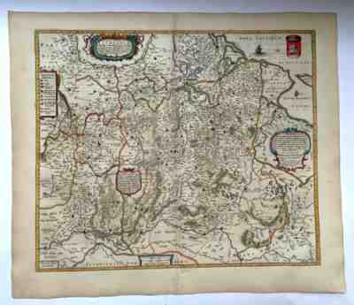
Sold on eBay Nov 12, 2022
LITHUANIA 1648 WILLEM BLAEU UNUSUAL LARGE ANTIQUE ENGRAVED MAP 17e CENTURY
Then, the sons of Willem, Johan and Joan, joined him in the firm. They produced their first atlas together in 1630 the "Atlas Appendix". Five years later, their produced their "Atlas Novus", edited in 4 languages.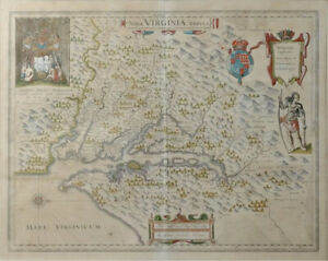
Sold on eBay April 9th, 2024
17th C. Map of VIRGINIA: Nova Virginia Tabula 2nd State 20”Height 24 2/8”Width
17th C. Map of Virginia: Nova Virginia Tabula 2nd State. Important Hand Colored early map, the second state of the first published map made after John Smith's map of the area around the Chesapeake Bay. Notable in part for its vignettes showing Native American Chief Powhatan, right side with bow and club, and upper left, presiding over a gathering in a dwelling where John Smith was held prisoner. The map shows Indian villages, identifies tribes, and, in a rare acknowledgement recognizes the places where Smith could go no further and relied on the information supplied by Native Americans, marking these areas with small Maltese crosses. Published by Willem Janszoon Blaeu (1571-1638) who purchased the copper plates of the first state from the widow of the publisher, Jodocus Hondius. On laid paper, with central crease, very minor foxing. Size: 20 inch Tall ……24 2/8 Inch Actual Currently Not Framed Please ask for additional Photos or other items needed.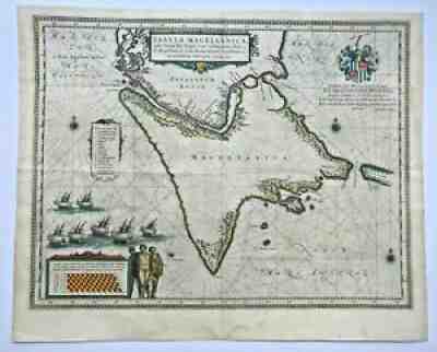
Sold on eBay Dec 21, 2021
STRAIT OF MAGELLAN 1640 WILLEM BLAEU LARGE UNUSUAL NICE ANTIQUE MAP 17th CENTURY
He was a diplomat and secretary to the Court in Holland. Then, the sons of Willem, Johan and Joan, joined him in the firm. They produced their first atlas together in 1630 the "Atlas Appendix". Five years later, their produced their "Atlas Novus", edited in 4 languages.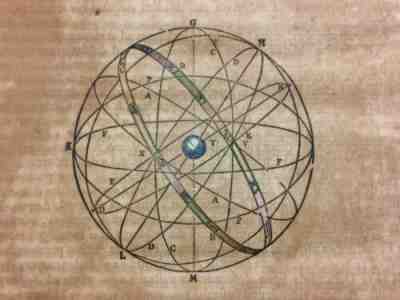
Sold on eBay Feb 7, 2023
ASTRONOMY 1662 JOAN BLAEU RARE LARGE ANTIQUE CELESTIAL MAP 17TH CENTURY
Then, the sons of Willem, Johan and Joan, joined him in the firm. They produced their first atlas together in 1630 the "Atlas Appendix". Five years later, their produced their "Atlas Novus", edited in 4 languages.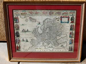
Sold on eBay August 23rd, 2023
W.J. Blaeu Europa Recens Descripta Hand Colored Map Engraving 1664
1664 – W. J. BLAEU – EUROPA RECENS DESCRIPTATitle: “Europa recens descripta a Guilielmo richly embellished map of Europe, which is an excellent representation of the decorative carte-a-figures style. Framed on both sides by five costumed figures, left border: Angli, Galli, Belgi, Castiliani, Venetiani and right border: Germani, Hungari, Bohemi, Poloni, Graeci. Along the upper edge runs a decorative border with nine European towns in oval frames: Amsterdam, Praga, Constantinopolis Venetia, Roma, Paris, London, Toledo and Lisboa. For European mapmakers their own continent contained few mysteries or secrets by the seventeenth century. However, the mythical island of Frisland still appears between Iceland and Greenland. The map is embellished with sailing ships, sea monsters, bears in northern Russia, and lions in North Africa and Neptune riding a dolphin and holding his trident.The map comes from rare Dutch edition atlas “Atlas Maior”, published by Joan Blaeu in 1664. Cartographer publisher: Willem Janszoon Blaeu (1571 – 1638)Sheet size: 44,8 x 58,3 cmPlace / Date:? 1664Technique: copper condition! Contemporary hand coloring. .Viewed through glass some brown spots from age, crease or fold line up the center, some frame nicks, as found, AS IS - NOT VIEWED OUT OF FRAME!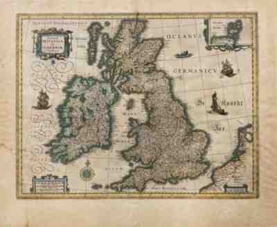
Sold on eBay Apr 28, 2022
BRITISH ISLES 1635 WILLEM BLAEU LARGE ANTIQUE ENGRAVED MAP 17e CENTURY
Willem Jansz. Old map of the British Isles by Joan and Willem Blaeu. (also written Guilielmus Janssonius) = Willem Janszoon Blaeu, was born in Uitgeest (Netherlands), near Alkmaar in 1571. Le Théâtre du Monde ou Nouvel Atlas.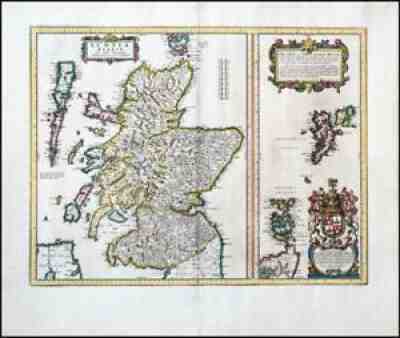
Sold on eBay Dec 25, 2020
1654 SCOTIA REGNUM Map of Scotland, Shetland & Orkney Isles by BLAEU
Joan was the son of Willem Janszoon Blaeu, founder of the Blaeu firm. It was most likely those profits that allowed the firm to publish the '. Theatrum Orbis Terrarum, Altlas Novus', their most significant and best known publication.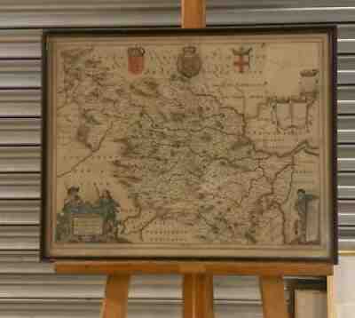
Sold on eBay Jan 01, 2022
Antique Willem Janszoon Blaeu Hand Coloured Map Of Yorkshire Dated 1658
Antique Willem Janszoon Blaeu Hand Coloured Map Of Yorkshire Dated 1658 In a glazed framed which measures approx 54 x 43 cmIn good condition for age. Will be well packed and sent via courierThanks for viewing and please take a look at all the other items I have for salePlease do not hesitate to message me if you require further information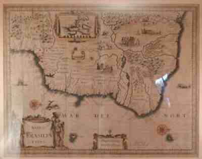
Sold on eBay Jul 14, 2021
Willem Janszoon Blaeu (1571 1638) Antique Map of Brazil~Hand Colored Engraving
Description: Up for sale is this fine antique map by Willem Janszoon Blaeu (1571-1638). Blaeu was a well known Dutch geogropher of his day who was based in Amsterdam. He died in 1638 and his business was run by his two sons, Cornelis (1610-1648) and Joan (1596-1673). The business thrived and grew under his sons. This map is Blaeu's first map of Brazil and is a very nice hand colored etching. Map includes an insert of the Baya de todos os Sanctos and images of native animals and people of Brazil. Note graphic images of cannibalism and a head hunting war party. Please see all pics for details.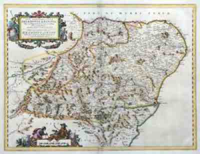
Sold on eBay Nov 05, 2020
